

Discover Naogaon: A Comprehensive Insight
About Naogaon
Naogaon district (Bengali: নওগাঁ জেলা) is a class “A” district under Rajshahi division with an area of 3435.67 sq km, is bounded by West Bengal of India on the north, Natore and Rajshahi districts on the south, Joypurhat and Bogura districts on the east, Chapai Nawabganj district and West Bengal (India) on the west. The district situated between latitudes 24°32′ and 25°13′ North, and longitudes 88°23′ and 89°10′ East.
History of Naogaon District
The name “Naogaon” has been derived from the juxtaposition of two distinct terms: ‘nao,’ a French word meaning “new,” and ‘gaon,’ which means “village” in Bengali.Together with, these two terms combine to form the meaning ‘new village.’ Historically, it is believed that this naming convention may reflect the formation of the place known as Naogaon.
Naogaon district town is located a few kilometers west of Santahar railway station in neighboring Bogra district. Historically, Naogaon was earlier headquartered at Manda and Bandaikhara, but was shifted to Naogaon on the banks of the Little Jamuna river to get rail connectivity.

The name “Naogaon” has been derived from the juxtaposition of two distinct terms: ‘nao,’ a French word meaning “new,” and ‘gaon,’ which means “village” in Bengali. Together, these two terms form the meaning “new village”.
Administration
Naogaon, firstly established as a subdivision under Rajshahi district in 1877, was later upgraded to a district in 1984. It consists of 3 municipality, 11 upazilas, 99 union parishads and 2795 villages.

Upazilas in Naogaon
Naogaon district has eleven upazila. These Upazilas are major part of local governance. Upazila structure was formed in Bangladesh in 1982. An upazila administration works under the district administration. Further, it is governed by elected councils known as Upazila Parishad.
List of upazila in Naogaon district below:
- Atrai Upazila
- Badalgachhi Upazila
- Dhamoirhat Upazila
- Manda Upazila
- Mohadevpur Upazila
- Naogaon Sadar Upazila
- Niamatpur Upazila
- Patnitala Upazila
- Porsha Upazila
- Raninagar Upazila
- Sapahar Upazila
Municipalities in Naogaon District
There are a total of 3 municipalities across Naogaon district. According to the 2011 census, some statistics of these three municipalities are presented here:
Dhamoirhat Municipality
- Area: 11.16 sq. km.
- Population: 15,006
- Male: 7,749
- Female: 7,257
- Density of population: 1,344 per sq.km.
Naogaon Sadar Municipality
- Area: 37.03 sq. km.
- Population: 150,549
- Male: 77,326
- Female: 73,223
- Density of population: 4,036 per sq.km.
Patnitala Municipality (Nazipur)
- Area: 11.81 sq. km.
- Population: 21,670
- Male: 11,238
- Female: 10,432
- Density of population: 1,835 per sq.km.
The total area for these three municipalities is 60 sq. km. with a combined population of 187,225. The average density of population of 3,120 per sq.km.
Driving Distance from Neighbouring District
Here are the driving distances from Naogaon district headquarters to all neighboring districts, based on Google Maps’ best routes as of 2024. Please note that actual arrival times may vary depending on road conditions.
Naogaon to Rajshahi
- Distance: 79.2 km
- Route: Naogaon – Rajshahi Highway/R685
- Time: About 1 hours 45 mins
Naogaon to Bogura
- Distance: 47.8 km
- Route: Naogaon – Bogura Highway/R545
- Time: About 1 hours 21 mins
Naogaon to Natore
- Distance: 50.6 km
- Route: Natore – Naogaon Highway
- Time: About 1 hours 23 mins
Naogaon to Chapainawabganj
- Distance: 90.0 km
- Route: Rajshahi – Naogaon Highway/R685
- Time: About 2 hours 25 mins
Naogaon to Joypurhat
- Distance: 42.4 km
- Route: Naogaon – Badalgachhi Hwy/R547 and Badalgachhi – Joypurhat Rd/Naogaon – Joypurhat Rd/R549
- Time: About 1 hours 26 mins
Archaeological Heritage in Naogaon District
- Paharpur Buddhist Vihara
- Jagaddal Vihara
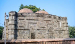
- Kusumba Mosque
- Halud Vihara
- Agrapuri Vihara
- Dubalhati Rajbari
- Balihar Rajbari


Weather of Naogaon
Bangladesh experiences a tropical climate divided into six seasons, and of course its northern district of Naogaon is no exception. The climate in this region is consistent with the national average. Typically, cooler weather begins in October and lasts until March. However, like the whole world, Naogaon has also experienced a rise in temperatures in recent years.

Monthly Average Maximum & Minimum Temperature of 2019
The temperature data presented here which was recorded at the Badalgachhi Meteorological Office Station in Naogaon district. This station-wise data is included in the Yearbook of Agricultural Statistics – 2021.1 The official name of the Badalgachhi meteorological station is the ‘Agricultural Meteorological Observatory,’ a government institution operating under the Directorate of Meteorology. And it is also a part of the Ministry of Defence.
| Month | Max Temp (°C) | Min Temp (°C) |
| Jan | 25.6 | 10.6 |
| Feb | 26.3 | 14.7 |
| Mar | 30.1 | 17.7 |
| Apr | 31.6 | 21.9 |
| May | 33.8 | 24.6 |
| June | 33.7 | 25.8 |
| July | 32.8 | 26.2 |
| Aug | 33.1 | 26.8 |
| Sep | 31.5 | 25.8 |
| Oct | 30.4 | 22.6 |
| Nov | 29.6 | 18 |
| Dec | 23.5 | 11.9 |
Maximum and Minimum Temperature – 2008-2010
The below chart will show the Max and Min Temperatures in Naogaon District during the years 2008-2010.2 Hover over any bar of the chart to see their data.
Maximum Recorded Temperature in Naogaon from 1990 to 2010
The climate of Naogaon is moderate in Bangladesh. The temperature of this region is relatively lower than Dhaka. The table below shows the maximum temperature of Naogaon from 1990 to 2010. Here, along with the year, on which date of the month this maximum temperature was recorded, it is also mentioned.
| Year | Max Temp (°C) | Date |
| 1990 | 40.00 | 23 April & 24 April |
| 1991 | 40.20 | 2 April & 4 May |
| 1992 | 42.70 | 14 April |
| 1993 | 39.20 | 12 May |
| 1994 | 42.50 | 5 May & 6 May |
| 1995 | 43.30 | 1 May & 25 May |
| 1996 | 42.00 | 21 April |
| 1997 | 40.20 | 11 May & 12 May |
| 1998 | 39.00 | 15 May |
| 1999 | 41.80 | 25 April |
| 2000 | 39.50 | 6 April |
| 2001 | 40.00 | 10 April and 24 April |
| 2002 | 39.20 | 20 May |
| 2003 | 40.30 | 12 April & 13 April |
| 2004 | 42.20 | 13 May |
| 2005 | 42.80 | 2 June |
| 2006 | 40.90 | 22 May |
| 2007 | 41.00 | 28 April |
| 2008 | 41.40 | 31 May |
| 2009 | 41.60 | 19 May |
| 2010 | 40.50 | 11 May |
Average Seasonal Variation of Rainfall
Year 2017
- Summer: 339 mm
- Monsoon: 950 mm
- Post Monsoon: 198 mm
- Winter: 9 mm
- Annual Average: 1496 mm
Year 2018
- Summer: 357 mm
- Monsoon: 714 mm
- Post Monsoon: 35 mm
- Winter: 27 mm
- Annual Average: 1132 mm3
For current weather of Naogaon, see here.
Population
As per the 2022 census, the population of Naogaon district is as follows:
- Total Population: 2,784,598
- Male: 1,374,312
- Female: 1,408,840
- Hijra: 173
- Sex Ratio: 97.55 males for every 100 females
For detailed population statistics of Naogaon district, see here.
Widowed and Divorced/separated Population (2011 census)
Widowed
- Male: 0.8 %
- Female: 10.2 %
Divorced/separated
- Male: 0.2 %
- Female: 1.4 %
Religious Population
As per the 2022 census, the religious population ratio is as follows:
- Muslim: 86.82%
- Hindu: 11.45%
- Christian: 0.77%
- Buddhist: 0.01%
- Others: 0.95% Other or not stated (Santal, Oraon, Mahali etc.)

Literacy Rates in Naogaon District
According to the 2022 census, the literacy rate is determined based on the population aged 7 years and older. The overall literacy rate, as well as the breakdown by gender, are provided below:
- Total Literacy Rate: 72.14%
- Male Literacy Rate: 74.66%
- Female Literacy Rate: 69.70%
- Hijra (third gender) Literacy Rate: 48.5%
This chart presents the literacy rate in Naogaon district for different genders: Male, Female, and Hijra.
Upazila-wise Literacy Rate Chart

Number of Educational Institutions
Naogaon district has a variety of educational institutions for students of all levels. From primary schools to technical institutes, the numbers of various educational institutions located in the district are given here.
- Government College: 6
- University: 1
- Medical College: 1
- Technical Training Center: 2 (Naogaon Sadar Upazila – 1, Raninagar Upazila – 1)
- Private College: 47
- Government Secondary School: 4
- Private Secondary School: 462
- Primary School: 1,374
- Government Technical Education Institute: 1
- Private Technical Education Institute: 51
- Madrasa: 350
- PTI (Primary Training Institute): 1
- Sarkari Shishu Paribar (State Children Home): 1
- Private Orphanage: 138
- Library: Government – 1, Private – 1


Notable Educational Institutions
Notable educational institutions in Naogaon district: Central Girl’s High School (1926), Naogaon Girl’s High School (1948), Raja Haranath High School (1990), Kaligram Rabindranath Institute (1910), Naogaon Medical College (2018), Naogaon Govt. Technical School and College, Chak Athita High School, Chakla High School (1916), Kritipur High School (1921), Naogaon Govt. College (1961), Mohadevpur Sarba Mongala (Pilot) High School (1921), Naogaon Zilla School (1917), Parimohan (PM) Girl’s High School (1909), Sapahar Pilot High School, Saraswatipur High School, Khidirpur High School, Basiruddin Memorial Co-operative (BMC) College (1946), Hapania High School and College, Nazipur Government College, Sapahar Government College.

Cultural Organisations
Club 668, press club 2, public library 27, dakbungalow 13, circuit house 1 and some others.


Number of Cinema Halls in Each Upazila
The table below provides information on the number of cinema halls in various Upazilas of Naogaon district. The data, based on the 2011 census, provides an overview of the entertainment infrastructure within the district.4 Please note that the current number of cinema halls may differ.
| Upazila | Number of Cinema Halls |
| Atrai | 1 |
| Badalgachhi | 1 |
| Dhamoirhat | 3 |
| Manda | 1 |
| Mohadevpur | 2 |
| Naogaon Sadar | 1 |
| Niamatpur | 1 |
| Patnitala | 3 |
| Porsha | 2 |
| Raninagar | 0 |
| Sapahar | 2 |
Orphanages in Naogaon District
The chart below visualizes the number of orphanages in each Upazila of the Naogaon district. According to the 2011 census data, Mohadevpur Upazila has the highest number of orphanages, with 27, while Atrai has the lowest, with just 3.
Villages in Naogaon district
Naogaon district is a village-dominated region like other regions of Bangladesh. According to the 2011 census, the total number of villages in this district is 2779. Among the 11 upazilas of the district, Niamatpur upazila has the highest number of 344 villages while Raninagar upazila has the lowest number of 174.

Rivers in Naogaon district
The district has 10 rivers on its land. They are: Atrai, Punarbhaba, Little Jamuna, Gur, Dhol, Tulshiganga, Nagor, Noor, Fokinni and Shiva.
See details about rivers in Naogaon district


Communication
Roadway
Paved roads: 401.25 km, including 15 km of HBB (High Bituminous Binder)
Unpaved roads: 99.75 km
Built by LGED: 5048 km
Built by Zilla Parishad: 1693.75 km (including both paved HBB and unpaved roads)
Main Bus Station: Baludanga Central Bus Terminal
Length of Highway
The chart above displays the length of highways in the Naogaon district, as reported in the Statistical Yearbook Bangladesh 2022, as well as stating these lengths in kilometers.5
Railrway
Total Railway: 27 km
Railway Stations: Raninagar, Sahagola, and Ahsanganj (Atrai)
Waterway
Waterway (river + canal) round the year: total 87 km in the district
Upazila Wise waterway:
- Atrai: 10 km
- Mohadevpur: 37 km
- Naogaon sadar: 40 km
Upazila-wise Waterway Chart
Out of the 11 upazilas in Naogaon district, only three maintain waterways that are accessible throughout the year, while the others do not. These waterways consist solely of rivers and canals, as per the 2011 census.6
This chart represents the waterway length by Upazila in Naogaon District. The length is stated in kilometers.
Number of Road Accidents in Naogaon District (2016-2019)


A road accident is an unforeseen tragedy. Although, such incidents are common in Bangladesh. Similarly, Naogaon district is no exception. In light of this, according to the Statistical Yearbook Bangladesh 2022, here are the figures for road accidents in the district from 2016 to 2019, including the number of people killed and injured.7
2016
- Accidents: 14
- Persons Killed: 12
- Persons Injured: 20
2017
- Accidents: 22
- Persons Killed: 23
- Persons Injured: 11
2018
- Accidents: 25
- Persons Killed: 27
- Persons Injured: 37
2019
- Accidents: 15
- Persons Killed: 13
- Persons Injured: 7
Main Crops
Naogaon is especially known for the production of food grains. The main crops of this district are: paddy, wheat, jute, mango, potato, sugarcane, oilseeds, pulses etc.
Cropping Land Types in Naogaon District
The lands in Naogaon district are considerably fertile compared to other regions of Bangladesh. As a result, different types of cultivation are seen. Based on the 2018 Bangladesh Agriculture Survey, here are the various types and quantities of cropping land:
- Single cropped land: 74,123.88 acres
- Double cropped land: 421,035.83 acres
- Triple cropped Land: 29,836.78 acres
- Four or more cropped land: 1,641.91 acres
- Fish land: 490.35 acres
This chart represents the different types of cultivated land in Naogaon district. The amount of land is stated in acres.

Fisheries in Naogaon
Fish Production Overview of 2021-2022
- Registered Fishermen: 17,751
- Fish Farmers: 33,276
- Trained Fish Farmers (Fiscal Year 2021-22): 3,550
- Government Fish Hatcheries: 3 (Including 2 rural hatcheries)
- Private Fish Hatcheries: 28
- Juvenile Fish Traders: 356
- Total Fish Production: 83,861 Metric Tons8

Fish Production and Demand Chart (2021-2022)
Hover over bars of the chart to see their data.
This chart represents the fish production, demand, and surplus in Naogaon District for the year 2021-2022. The data is stated in metric tons.
Fish Demand Calculation Method
The total fish demand was calculated based on the daily per person requirement of 60 grams, and given that the total population of Naogaon district was 2,784,598, the annual total fish demand amounted to 60,982.69 metric tons for the 2021-2022 year.
OMS Dealers In Naogaon District
For individuals and families with limited financial ability, the government offers essential items like rice, pulses, flour, cooking oil, salt, etc., at reduced prices through the Open Market Sales (OMS) program. This program operates nationwide, including in Naogaon, and is concurrently managed by the Department of Food. Below, for instance, are the names, addresses, and phone numbers of OMS dealers in the Naogaon district.9
| Dealer Name | Dealer Address | Mobile Number |
| Al Helal | Chalkdev para, Khanpara, Naogaon | 01824-886393 |
| Shyamal Kumar Biswas | Arji Naogaon, Naogaon | 01728-268389 |
| Subrata Poddar (Naru) | Dabpatti (ডাবপট্টি), Naogaon | 01740-866882 |
| Rahmat Ali Molla | Aratdarapatti (আড়তদারপট্টি), Naogaon | 01713-781379 |
| Ariful Islam | Par-Naogaon, Naogaon | 01718-882565 |
| Mamunur Rahman Milon | Hat Naogaon, Naogaon | 01312-474408 |
| A.B.M. Shamim Kabir | Madhyadurgapur (মধ্যদূর্গাপুর), Naogaon | 01931-174123 |
| Hosen Ali | Chokpran, Taltali, Naogaon | 01711-249979 |
| Abdul Wahed | Khalishakuri, Naogaon | 01710-136340 |
| Asaduzzaman (Sohel) | Chalk Enayet, Naogaon | 01718-431678 |
| Utpal Pal | Arji Naogaon, Naogaon | 01712-982590 |
| Palash Kumar Das | Hat-Naogaon, Naogaon | 01676-096852 |
| Azmal Hosen (Badsha) | Boalia, Naogaon | 01712-652149 |
| Abdul Mannan | Kazir Mor, Naogaon | 01711-267933 |
| Mosharaf Hosen (Shanto) | Chalk Gobind(চকগৌবিন্দ), Naogaon | 01711-937070 |
| Sukhen Sardar | Parail, Raninagar, Naogaon | 01759-036121 |
Main Fruits
Banana, mango, jackfruit, guava, litchi, orange, coconut etc.
Recently, Naogaon district has made great progress in mango production. Below is a chart of annual mango production progress.
This chart represents the yearly mango production in Naogaon District. The production is stated in metric tons.
Haats and Bazaars in Naogaon District
Naogaon district is home to many haats and bazaars. A haat is a type of marketplace that sets up on one or several specific days of the week, while bazaars open every day. Both haats and bazaars are essential trading spots in rural areas, where people buy and sell a range of items, from daily necessities to other goods. In some of the larger haats, people also trade in livestock and furniture.
As of the 2011 census, the district has 248 haats and bazaars. Here is an upazila-wise chart of haats and bazaars in each upazila:

Upazila-wise Haats and Bazaars Chart
This chart represents the number of Haat and bazaar in each Upazila of Naogaon district as per the 2011 census.
Health Facicities in Naogaon
Doctor’s Fees
Below is a health related chart based on the 2011 census data. It displays the consultation fees patients were required to pay in non-government clinics, hospitals, or consultation centers during that period. The fees at that time varied depending on the type of doctor consulted. It’s worth noting that today’s doctor fees are significantly higher than that time.
This chart represents the average doctor’s fee in Naogaon district per patient as per the 2011 census. The fee is stated in taka.


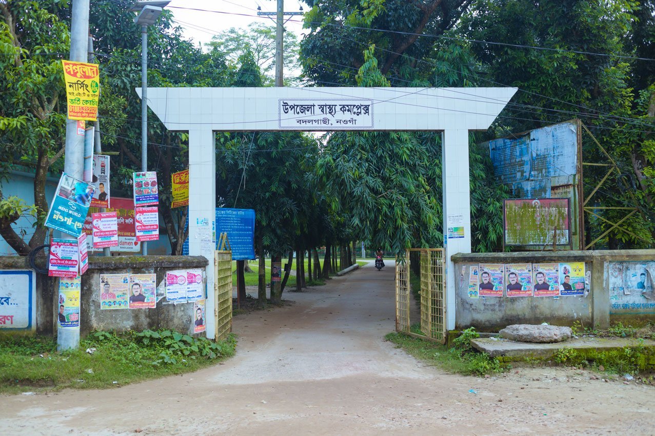
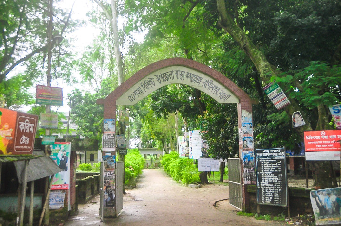
Health Centres in Naogaon District
District hospital 1, Medical College 1, upazila heath complex 10, union heath centre 35, family planning centre 42, christian missionary hospital 1.
Frequently Asked Questions about Naogaon

Why is Naogaon famous?
Naogaon is famous for its historical monuments, such as the Somapura Mahavihara, Kusumba Shahi Mosque, Patisar Rabindra Kachari Bari, Jagaddal Mahavihar, and Dubalhati Rajbari. Additionally, the district plays a significant role in agriculture, including rice production, with numerous rice mills in the area. Recently, Naogaon has also gained recognition for its mango production.
How many upazilas are there in Naogaon district?
There are 11 upazilas in Naogaon district. The names of the upazilas are Atrai, Badalgacchi, Dhamoirhat, Manda, Mohadevpur, Naogaon Sadar, Niamatpur, Patnitala, Porsha, Raninagar, and Sapahar.
How many union councils are there in Naogaon district?
There are 99 union councils in Naogaon district. Union councils are also called Union Parishads.
What type of town is Naogaon?
Naogaon town is the headquarters of the Naogaon district and the location of the Naogaon Sadar Upazila headquarters. It is located near the Choto Jamuna River and is home to the newly established Naogaon Medical College. The town does not have a railway station.
How many police stations and upazilas are there in Naogaon district?
‘Thana’ refers to both a police station and an upazila (sub-district). Naogaon district has 11 police stations, 3 police outposts, and 11 upazilas.
What is the NWD code of Naogaon?
The NWD code for Naogaon is 074. The NWD code also refers to the TNT/BTCL code.
How many rivers are there in Naogaon district?
Naogaon district has 10 rivers. The main river of Naogaon district is Atrai.
Source and References
- Yearbook of Agricultural Statistics – 2021 ↩︎
- District Statistics 2011, Naogaon ↩︎
- Statistical Yearbook Bangladesh 2022 ↩︎
- District Statistics 2011, Naogaon ↩︎
- Statistical Yearbook Bangladesh 2022 ↩︎
- District Statistics 2011, Naogaon ↩︎
- Statistical Yearbook Bangladesh 2022 ↩︎
- জেলা মৎস্য কর্মকর্তার কার্যালয়, নওগাঁ, At a Glance ↩︎
- Office of the District Food Controller, Naogaon – OMS Naogaon Dealer List ↩︎
Some data sourced from: Naogaon District Portal


[…] Upazila (Bengali: রাণীনগর উপজেলা) is one of the 11 upazilas of Naogaon district. It has an area of 258.33 sq km. and bounded by Naogaon sadar and Adamdighi upazilas, […]
[…] on 05 January 2014. Which is also known as the Bangladesh General National Election 2014. Naogaon District has 6 parliamentary seats out of 300 in the National Assembly. The elections resulted in the […]
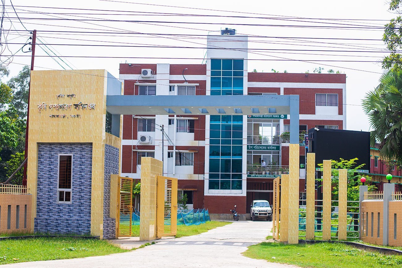
[…] Naogaon is a northern district of Bangladesh which is renowned for its rich agriculture. Agriculture is the backbone of its economy. This district belongs to the Barind region and the Barind Multipurpose Development Authority (BMDA) is responsible for its agricultural development. The farmers here produce a diverse range of agri products, and the agricultural output of this district significantly contributes to the country’s agriculture sector. According to the Year Book of Agricultural Statistics of Bangladesh 2022, the district has 6,11,822 holdings. Of these, 63.83% have farming facilities where they grow different kinds of crops.1 […]
[…] in the northern part of Bangladesh, Naogaon district is home to a diverse population. This article will provide a comprehensive look at […]
[…] Upazila (Bangla: আত্রাই উপজেলা) is a southern upazila (sub-district) of Naogaon district. Previously, Atrai was a thana (Bangla: থানা) that established in 1916. It has an area of […]
[…] (in Bangla: মহাদেবপুর) Upazila is one of the 11 Upazila (sub-district) of Naogaon District. It is located west side of the Naogaon district headquarter. Area of the Upazila is […]
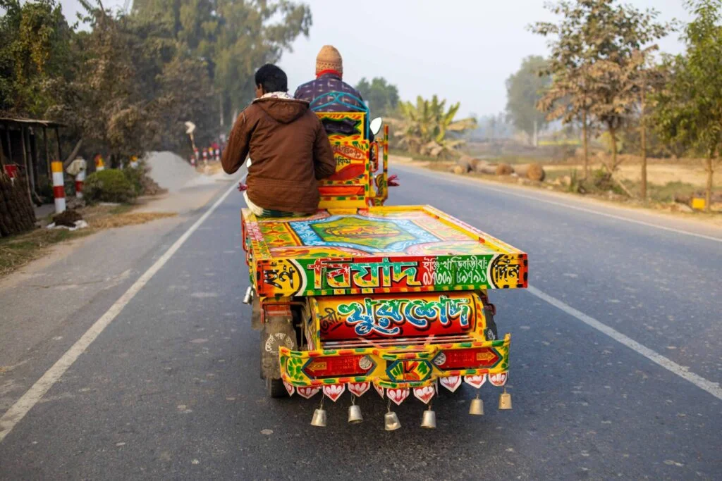
[…] friends or to have some snacks with them. In big cities, people often choose restaurants, but in Naogaon, street food shops are the go-to destination for many. Just like in other regions of Bangladesh, […]
[…] Union Parishads are the primary local administrative units providing services to rural citizens. Naogaon district has 99 Union Parishads (local councils). In this post, a complete list of Union Parishads in […]
[…] বিহার) or Paharpur Vihara is located in Paharpur village, 34 km from Naogaon district town and about 16 km north of Badalgachhi upazila headquarters. It is near Jamalganj Railway […]
[…] Department. This historic site is located in Patisar village, approximately 36 kilometers south of Naogaon district town. As per the Government of Bangladesh Gazette dated 08 July 1993 and 8 September 1994, […]
[…] for assistance. It’s a first thing a citizen can do. There are 11 police stations across Naogaon district, operated under the Ministry of Home Affairs. Additionally, there are 3 police outposts in various […]
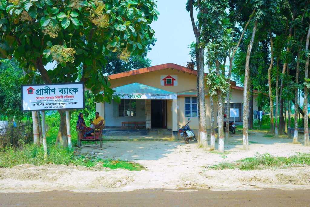
[…] Dutch-Bangla Bank Ltd. is a renowned private bank, offering both branch and ATM services in Naogaon. The bank has branch and ATM services in Naogaon too. This bank once earned a reputation for having […]
[…] we put ChatGPT to the test, exploring its knowledge about Naogaon, one of the 64 districts in Bangladesh. There is a lot of information on the internet about this […]
[…] held on January 07, 2024. Which is also known as the Bangladesh General National Election 2024. Naogaon District has 6 parliamentary seats out of 300 in the National Assembly(জাতীয় সংসদ). The […]
[…] রাজবাড়ি) or Dubalhati Royal Palace is a 200 years old palace complex in Naogaon. The correct spelling of the place is Dubalhati Rajbari. The word ‘Rajbari’ (Bangla: […]
[…] Naogaon district has a total of 48 union land offices. These offices provide essential land services at the local level. They are the final layer in the Bangladesh Government’s land-related administrative structure. Each office consists of one or more Union Parishad areas. As a result, this integration has led to the union land offices being named after the unions they serve. […]
[…] উপজেলা) or Badalgachi or Bodolgachi is located 21 km north from the zero point of Naogaon district town according to Google Maps. This is an upazila under the Naogaon district that is […]
[…] also known as ‘Naogaon Degree College‘, is a prominent Govt. educational institution in Naogaon district. It is situated beside the bank Little Jamuna River in the Bangabaria area, to the north […]