
Naogaon district is rich in heritage and archaeological monuments, and it has 14 historical places. These sites have also been declared as protected monuments by the government of the People’s Republic of Bangladesh. The list has been published by the Directorate of Archeology of the Government of the People’s Republic of Bangladesh.
Explore List of Naogaon’s Historical Places and Tourist Spots

Upazila-wise List of Historical Places in Naogaon District
Atrai Upazila
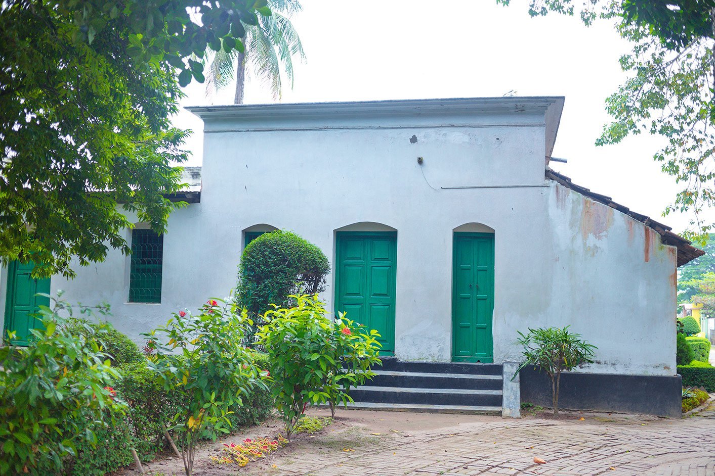
01. Rabindranath Tagore’s Patisar Kachari Bari and Adjacent Monuments
Bengali name: কবি রবীন্দ্রনাথ ঠাকুরের পতিসর কাচারী বাড়ি ও তৎসংলগ্ন কীর্তিসমূহ
Geo Location: Latitude: 24°37’00.5″N, Longitude: 89°05’21.8″E
Notification/Gazette & Date: Bangladesh Gazette, 8th July 1993, 8th September 1994
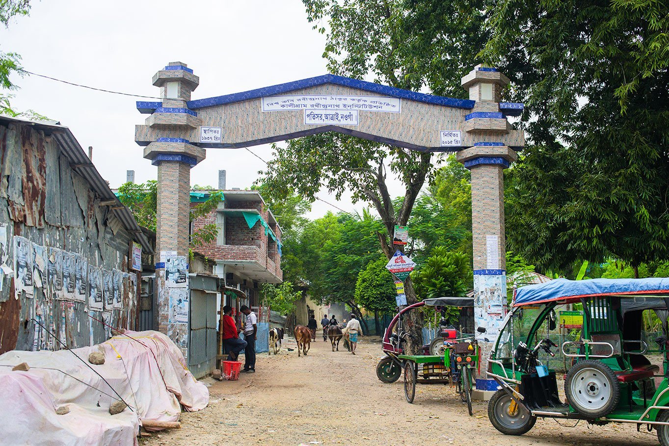
02. Kaligram Rathindranath Institution
Bengali name: কালীগ্রাম রথীন্দ্রনাথ ইনস্টিউশন
Geo Location: Latitude: 24°36’56.7″N, Longitude: 89°05’16.3″E
Notification/Gazette & Date: Bangladesh Gazette, 31st August 2017
03. Islamganthi Jame Mosque
Bengali name: ইসলামগাঁথী জামে মসজিদ
Geo Location: Latitude: 24.595063320950146, Longitude: 89.02516721087608
Notification/Gazette & Date: Bangladesh Gazette, 28th February 2019


Badalgachhi Upazila
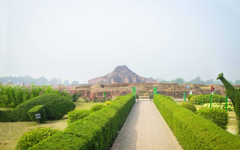
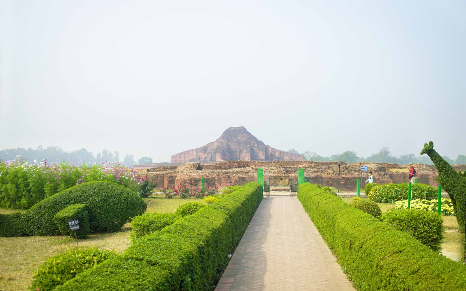
04. Somapura Mahavihara (Paharpur Buddhist Monastery)
Bengali name: সোমপুর মহাবিহার
Geo Location: Latitude: 25°01’52.1″N, Longitude: 88°58’37.1″E
Notification/Gazette & Date: No. 211-Misc. Dt. 15-7-1919
05. Satyapirer Bhita
Bengali name: সত্যপীরের ভিটা
Geo Location: Latitude: 25°01’50.2″N, Longitude: 88°58’53.1″E
Notification/Gazette & Date: No. 6300 L.A. 30 May 1934
06. Holudbihar Dhibi (Yellow Monastery)
Bengali name: হলুদবিহার ঢিবি
Geo Location: Latitude: 24°55’56.9″N, Longitude: 88°58’19.9″E
Notification/Gazette & Date: Ministry of Education, Cultural Affairs & Sports Division No.-LB/1A-31/76/566, Date: 28th August 1976
Dhamoirhat Upazila
07. Mohisantosh Mosque
Bengali name: মহীসন্তোষ মসজিদ
Geo Location: Latitude: 25.180144712722633, Longitude: 88.76884532488617
Notification/Gazette & Date: The Calcutta Gazette Dt. the 16th April, 1925
08. Agradigun Mound
Bengali name: আগ্রাদ্বিগুন মাউন্ড
Geo Location: Latitude: 25°10’40.8″N, Longitude: 88°42’14.2″E
Notification/Gazette & Date: No. 1238 Mis. Dt. 22nd November 1920
09. Jagaddal Bihar
Bengali name: জগদ্দল বিহার
Geo Location: Latitude: 25°09’32.3″N, Longitude: 88°53’15.5″E
Notification/Gazette & Date: No. 1193 Mis. Dt. 25 June 1923
10. Badal Pillar/Garuda Pillar (Bheemer Panti)
Bengali name: বাদল পিলার/গারুদা পিলার)
Geo Location: Latitude: 25°06’19.3″N, Longitude: 88°56’04.3″E
Notification/Gazette & Date: No. 1238 Mis. Dt. 22 November 1920
Naogaon Sadar Upazila
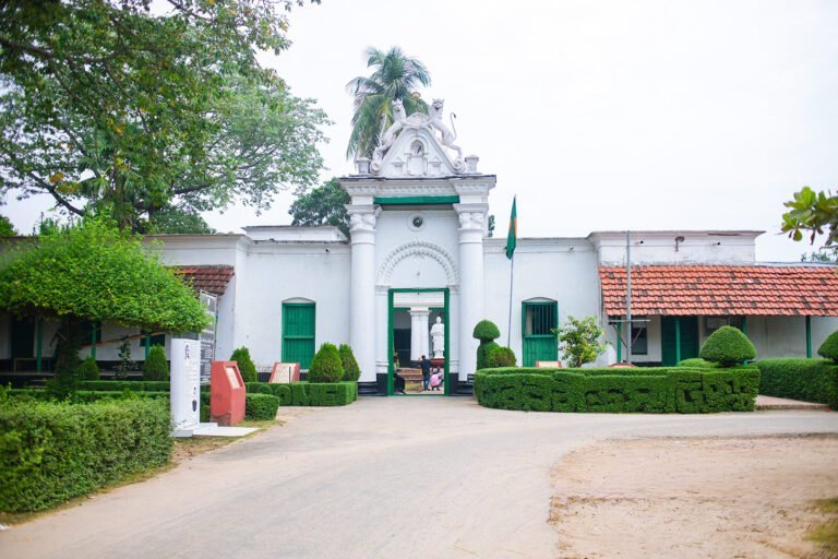
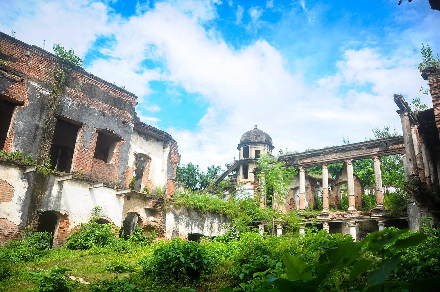
11. Dubalhati Palace (Rajbari)
Bengali name: দুবলহাটি প্রাসাদ (রাজবাড়ি)
Geo Location: Latitude: 24°47’12.2″N, Longitude: 88°52’59.2″E
Notification/Gazette & Date: Bangladesh Gazette, 2nd April 1987
Manda Upazila
12. Chauja Mosque
Bengali name: চৌজা মসজিদ
Geo Location: N/A
Notification/Gazette & Date: No.-Sha:6/Pratna: Adhi:- 16/98/710 (1), Date: 19-06-2002
13. Kusumba Mosque
Bengali name: কুসুম্বা মসজিদ
Geo Location: Latitude: 24°45’10.0″N, Longitude: 88°40’53.3″E
Notification/Gazette & Date: No. 585-E Dt. 14-3-1910

Patnitala Upazila
14. Dhibar Pillar (Kaibarta Pillar)
Bengali name: ধীবর পিলার
Geo Location: Latitude: 25°07’20.0″N, Longitude: 88°37’14.4″E
Notification/Gazette & Date: The Calcutta Gazette Dt. 8th October 1931
Photo: Rumon Anam