Tag Upazila Information

2 no. Kirtipur Union Parishad building in Naogaon Sadar Upazila.

Naogaon Union Parishad Secretary List

In Bangladesh, each Union Parishad has a government appointed Union Secretary who serves as the chief administrative officer. They assist in maintaining official records, managing public services, implementing government programs, and supporting the Union Chairman in…

Raigaon High School in Mataji Hat, Mohadevpur. This school established 1946 AD.

Education in Naogaon District

The scenario of education in Naogaon district, including statistics, educational institutional amounts, student and teacher information, and more, will be provided here. Literacy Naogaon District Historical Literacy Rate As per the 2022 census, the present literacy…

Ahsanganj Railway Station in Atrai town on the Bank of Atrai River, Naogaon, 2023.

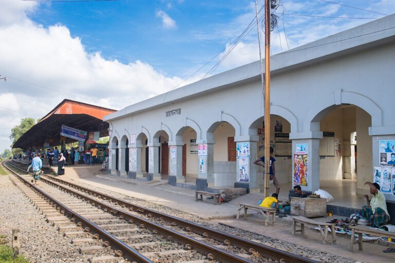
Photo Tour of Atrai Upazila, Naogaon

Make a journey on a captivating photo tour of Atrai Upazila in Naogaon, capturing its important landscapes, historical sites, urban and rural lifestyle and cultural richness through vibrant imagery. Through this visual gallery, discover the Atrai…

Ethnic Population in Naogaon

Upazila-wise Ethnic Population Count Upazila Total Male Female Atrai 19 8 11 Badalgachhi 8377 4101 4276 Dhamoirhat 12156 6005 6151 Mohadevpur 18195 9079 9116 Manda 3734 1847 1887 Naogaon Sadar 1329 641 688 Niamatpur 29710 14707…

UNO (Upazila Nirbahi Officer) Office, nestled in the Badalgachhi Upazila Complex, captured in 2023 AD.

Badalgachhi Upazila, Naogaon

Badalgachhi Upazila (Bangla: বদলগাছী উপজেলা) also known as Badalgachi or Bodolgachi is located 21 km north from the zero point of Naogaon district town according to Google Maps. This is an upazila under the Naogaon district…

Green surroundings at Upazila Parishad Gate, Mohadevpur

Mohadevpur Upazila, Naogaon

Mohadevpur Upazila (Bangla: মহাদেবপুর উপজেলা), also known as Mohadebpur, is a sub-district (upazila) of Naogaon District in the Rajshahi Division of Bangladesh. Mohadevpur is only upazila in Naogaon that has no border with any neighboring districts.…

Patnitala Upazila road and gate beside Nazipur-Dhamoirhat road, leading to Upazila Parishad administration complex, 2024.

Patnitala Upazila, Naogaon

Patnitala Upazila (Bangla: পত্নীতলা উপজেলা) also known as Potnitola is an upazila (sub-district) of Naogaon district within the Rajshahi Division of Bangladesh. While the name of the upazila is Patnitala, it is located in Nazipur (নজিপুর)…

Dhamoirhat Upazila Administrative Building within Upazila Parishad premises, 2024.

Dhamoirhat Upazila, Naogaon

Learn Details About Dhamoirhat Upazila Dhamoirhat Upazila (Bangla: ধামইরহাট উপজেলা) is a northern upazila (sub-district) in Naogaon district. The upazila is surrounded by Western Bengal (India) on the north, Badalgachhi and Patnitala upazilas on the south…

South-side view of the historical site Kusumba Mosque, Naogaon, Bangladesh.

Manda Upazila, Naogaon

Manda Upazila (Bangla: মান্দা উপজেলা) is a sub-district (upazila) of Naogaon District in the Rajshahi Division of Bangladesh. The upazila headquarters is located 33 km west of Naogaon district town and 49 km north of the…

A white colored Patisar Rabindra Kachari Bari (রবীন্দ্র কাছারি বাড়ি) building in Atrai Upazila of Naogaon district. Photo taken in 2023 AD.

Atrai Upazila, Naogaon

The map of Atrai Upazila displays its administrative areas within Naogaon district. Learn Details About Atrai Upazila Atrai Upazila (Bangla: আত্রাই উপজেলা) is a southern upazila (sub-district) of Naogaon district. Previously, Atrai was a thana (Bangla:…